Image Credit: Tom Stelling
Year Erected: 1957
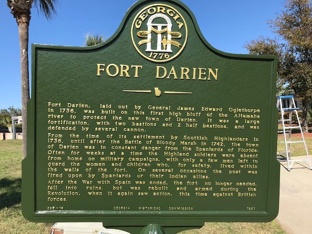
Marker Text: Fort Darien, laid out by General James Edward Oglethorpe in 1736, was built on this first high bluff of the Altamaha river to protect the new town of Darien. It was a large fortification, with two bastions and 2 half bastions, and was defended by several cannon.
From the time of its settlement by Scottish Highlanders in 1736, until after the Battle of Bloody Marsh in 1742, the town of Darien was in constant danger from the Spaniards of Florida. Often for weeks at a time the Highland soldiers were absent from home on military campaigns, with only a few men left to guard the women and children who, for safety, lived within the walls of the fort. On several occasions the post was fired upon by Spaniards or their Indian allies.
After the War with Spain was ended, the fort, no longer needed, fell into ruins, but was rebuilt and armed during the Revolution, when it again saw action, this time against British forces.