Image Courtesy of Habersham County
Year Erected: 1953
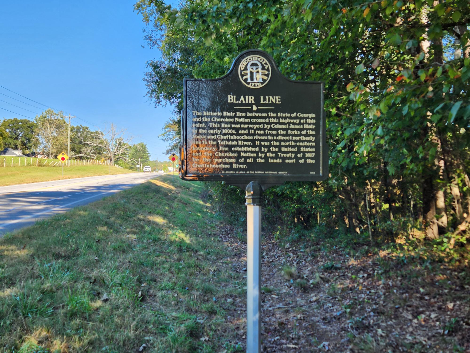
Marker Text: The historic Blair line between the State of Georgia and the Cherokee Nation crossed this highway at this point. This line was surveyed by Colonel James Blair in the early 1800s, and it ran from the forks of the Soque and Chattahoochee rivers in a direct northerly line to the Tallulah River. It was the north-eastern boundary line established by the United States and the Cherokee Nation by the Treaty of 1817 for the purchase of all the lands east of the Chattahoochee River.
Re-erected in 2-22 by the Georgia Historical Society
Tips for Finding This Site: On Clarkesville Hwy near Cannon Bridge Rd near Clarkesville. Near the Mt. Veron Church.