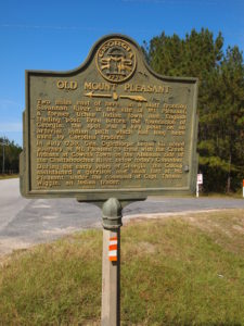
Marker Text: Two miles east of here, on a bluff fronting Savannah River is the site of Mt. Pleasant, a former Uchee Indian town and English trading post. Even before the foundation of Georgia, the spot was a key point on an arterial Indian path which had long been used by Carolina traders.
In July 1739, Gen Oglethorpe began his noted journey at Mt. Pleasant to treat with the Creek Indians at Coweta Town on the Alabama side of the Chattahoochee River, below today's Columbus.
During the early years of Georgia, the Colony maintained a garrison and small fort at Mt. Pleasant, under the command of Capt. Thomas Wiggin, an Indian trader.
Tips for Finding This Marker: Northeast of intersection at Clyo-Kildare Road and Taylor Chapel Road in Clyo.

